
Mochuelo Bajo topographic map
Interactive map
Click on the map to display elevation.
About this map
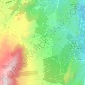
Name: Mochuelo Bajo topographic map, elevation, terrain.
Location: Mochuelo Bajo, Monteblanco, Bogotá, 110511, Colombia (4.48828 -74.16819 4.52828 -74.12819)
Average elevation: 9,623 ft
Minimum elevation: 8,488 ft
Maximum elevation: 11,312 ft