
Thank you for supporting this site ❤️
Make a donation
Make a donation
Gear up for your next adventure:
As an Amazon Associate, this site earns from qualifying purchases at no extra cost to you.
Lenzerheide topographic map
Click on the map to display elevation.
Thank you for supporting this site ❤️
Make a donation
Make a donation
Gear up for your next adventure:
As an Amazon Associate, this site earns from qualifying purchases at no extra cost to you.
About this map
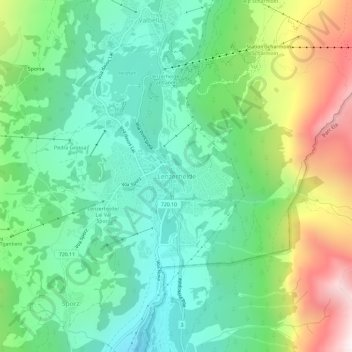
Name: Lenzerheide topographic map, elevation, terrain.
Location: Lenzerheide, Vaz/Obervaz, Albula, Grisons, 7078, Switzerland (46.70803 9.53844 46.74803 9.57844)
Average elevation: 5,653 ft
Minimum elevation: 4,341 ft
Maximum elevation: 8,471 ft
Thank you for supporting this site ❤️
Make a donation
Make a donation
Gear up for your next adventure:
As an Amazon Associate, this site earns from qualifying purchases at no extra cost to you.