
Opsterland topographic map
Interactive map
Click on the map to display elevation.
About this map
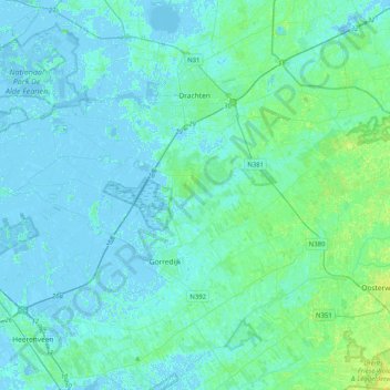
Name: Opsterland topographic map, elevation, terrain.
Location: Opsterland, Friesland, Nederland (52.96436 5.92758 53.12921 6.33206)
Average elevation: 7 ft
Minimum elevation: -16 ft
Maximum elevation: 43 ft