
Furnace topographic map
Interactive map
Click on the map to display elevation.
About this map
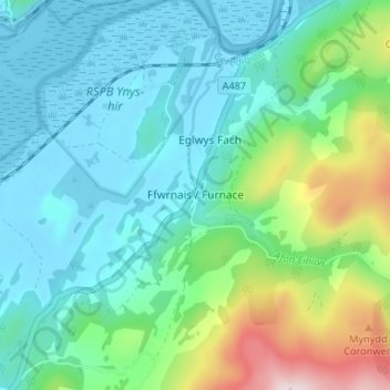
Name: Furnace topographic map, elevation, terrain.
Location: Furnace, Ceredigion, Wales, SY20 8PJ, United Kingdom (52.51818 -3.96057 52.55818 -3.92057)
Average elevation: 351 ft
Minimum elevation: -7 ft
Maximum elevation: 1,532 ft