
Thank you for supporting this site ❤️
Make a donation
Make a donation
Gear up for your next adventure:
As an Amazon Associate, this site earns from qualifying purchases at no extra cost to you.
Bevaix topographic map
Click on the map to display elevation.
Thank you for supporting this site ❤️
Make a donation
Make a donation
Gear up for your next adventure:
As an Amazon Associate, this site earns from qualifying purchases at no extra cost to you.
About this map
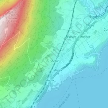
Name: Bevaix topographic map, elevation, terrain.
Location: Bevaix, La Grande-Béroche, Neuchâtel, 2022, Switzerland (46.91527 6.77226 46.95008 6.83965)
Average elevation: 1,969 ft
Minimum elevation: 1,385 ft
Maximum elevation: 4,324 ft
Thank you for supporting this site ❤️
Make a donation
Make a donation
Gear up for your next adventure:
As an Amazon Associate, this site earns from qualifying purchases at no extra cost to you.