
Schäftlarn topographic map
Interactive map
Click on the map to display elevation.
About this map
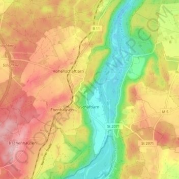
Name: Schäftlarn topographic map, elevation, terrain.
Location: Schäftlarn, Landkreis München, Upper Bavaria, Bavaria, Germany (47.95687 11.40397 48.01324 11.47550)
Average elevation: 2,103 ft
Minimum elevation: 1,781 ft
Maximum elevation: 2,392 ft