
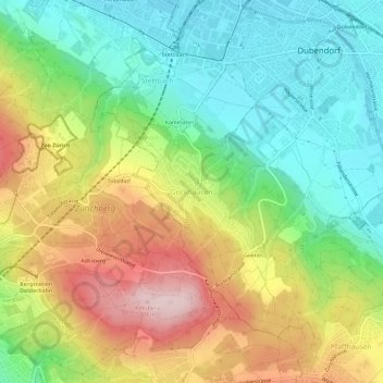
Gockhausen topographic map
Interactive map
Click on the map to display elevation.
About this map
Name: Gockhausen topographic map, elevation, terrain.
Location: Gockhausen, Bezirk Uster, Zurich, 8053, Suisse (47.36204 8.57864 47.40204 8.61864)
Average elevation: 1,775 ft
Minimum elevation: 1,401 ft
Maximum elevation: 2,320 ft