
Represa San Lorenzo topographic map
Interactive map
Click on the map to display elevation.
About this map
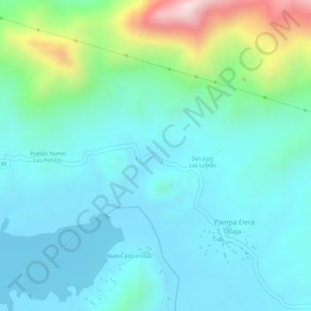
Name: Represa San Lorenzo topographic map, elevation, terrain.
Average elevation: 1,270 ft
Minimum elevation: 955 ft
Maximum elevation: 2,352 ft
Other topographic maps
Click on a map to view its topography, its elevation and its terrain.
El Sauce
Perú > Departamento de Piura > Las Lomas > El Sauce
El Sauce, Las Lomas, Provincia de Piura, Departamento de Piura, Perú
Average elevation: 1,736 ft