
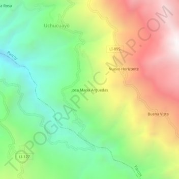
Jose Maria Arguedas topographic map
Interactive map
Click on the map to display elevation.
About this map
Name: Jose Maria Arguedas topographic map, elevation, terrain.
Location: Jose Maria Arguedas, Parcoy, Pataz, La Libertad, Perú (-8.02092 -77.58045 -7.98092 -77.54045)
Average elevation: 8,881 ft
Minimum elevation: 6,319 ft
Maximum elevation: 12,352 ft
Other topographic maps
Click on a map to view its topography, its elevation and its terrain.
Llacuabamba
Perú > La Libertad > Parcoy
Llacuabamba, Parcoy, Pataz, La Libertad, Perú
Average elevation: 12,224 ft