Somersal Herbert CP topographic map
Interactive map
Click on the map to display elevation.
About this map
Name: Somersal Herbert CP topographic map, elevation, terrain.
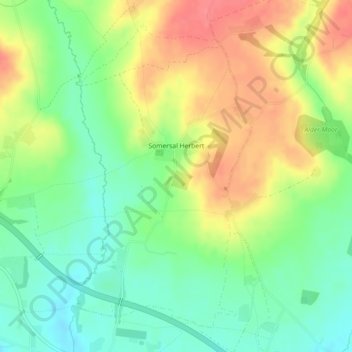
Average elevation: 348 ft
Minimum elevation: 246 ft
Maximum elevation: 476 ft

Click on the map to display elevation.
Name: Somersal Herbert CP topographic map, elevation, terrain.
Average elevation: 348 ft
Minimum elevation: 246 ft
Maximum elevation: 476 ft