Geolocate

New Bedford topographic map

Click on the map to display elevation.

About this map
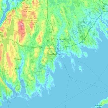
Name: New Bedford topographic map, elevation, terrain.

Location: New Bedford, Bristol County, Massachusetts, 02740, United States (41.47622 -71.09421 41.79622 -70.77421)

Average elevation: 56 ft

Minimum elevation: -49 ft

Maximum elevation: 338 ft

Bristol County trails, hiking, mountain biking, running and outdoor activities

Gear up for your next adventure:

📚Navigation Handbooks - Master the art of reading topographic maps and using a compass
🪶Compact Camp Shovel - Folding shovel for campsite tasks
🧣Merino Neck Gaiters - Multi-functional headwear for wind and sun protection
🔊Portable Camp Speaker - Music and alerts at camp
🚁Photography Drones - Capture stunning aerial views of landforms and topography

As an Amazon Associate, this site earns from qualifying purchases at no extra cost to you.