
Miguel Hidalgo y Costilla topographic map
Interactive map
Click on the map to display elevation.
About this map
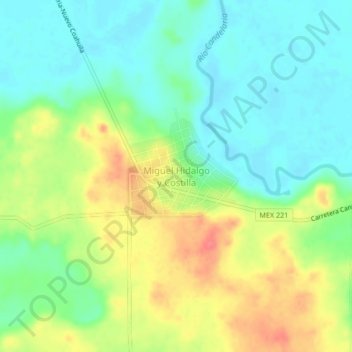
Name: Miguel Hidalgo y Costilla topographic map, elevation, terrain.
Location: Miguel Hidalgo y Costilla, Candelaria, Campeche, México (17.86790 -90.86632 17.90790 -90.82632)
Average elevation: 187 ft
Minimum elevation: 105 ft
Maximum elevation: 312 ft