
Kel Karang Panjang topographic map
Interactive map
Click on the map to display elevation.
About this map
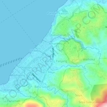
Name: Kel Karang Panjang topographic map, elevation, terrain.
Location: Kel Karang Panjang, Ambon, Moluccas, 97124, Indonesia (-3.71131 128.16850 -3.67131 128.20850)
Average elevation: 151 ft
Minimum elevation: 0 ft
Maximum elevation: 853 ft