
Tokoiti topographic map
Interactive map
Click on the map to display elevation.
About this map
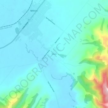
Name: Tokoiti topographic map, elevation, terrain.
Location: Tokoiti, Milton, Clutha District, Otago, 9220, New Zealand (-46.15282 169.95318 -46.11282 169.99318)
Average elevation: 164 ft
Minimum elevation: 13 ft
Maximum elevation: 981 ft