
Cantalupo topographic map
Interactive map
Click on the map to display elevation.
About this map
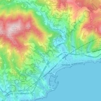
Name: Cantalupo topographic map, elevation, terrain.
Location: Cantalupo, Varazze, Savona, Ligurien, 17019, Italien (44.34486 8.54685 44.38486 8.58685)
Average elevation: 476 ft
Minimum elevation: -7 ft
Maximum elevation: 1,460 ft