
Anjar Taluka topographic map
Interactive map
Click on the map to display elevation.
About this map
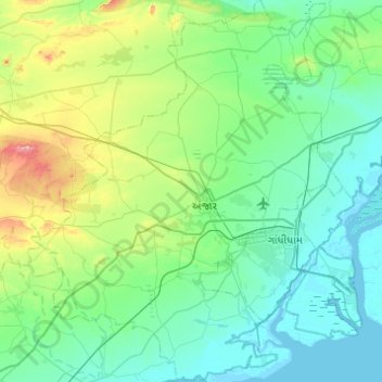
Name: Anjar Taluka topographic map, elevation, terrain.
Location: Anjar Taluka, Kachchh, Gujarat, India (22.90300 69.80172 23.35345 70.20521)
Average elevation: 197 ft
Minimum elevation: 0 ft
Maximum elevation: 1,106 ft
Other topographic maps
Click on a map to view its topography, its elevation and its terrain.
Khirsara Nana
India > Gujarat > Anjar Taluka > Khirsara Nana
Khirsara Nana, Anjar Taluka, Kachchh, Gujarat, 370115, India
Average elevation: 200 ft