
Thank you for supporting this site ❤️
Make a donation
Make a donation
Gear up for your next adventure:
As an Amazon Associate, this site earns from qualifying purchases at no extra cost to you.
Sukaraja topographic map
Click on the map to display elevation.
Thank you for supporting this site ❤️
Make a donation
Make a donation
Gear up for your next adventure:
As an Amazon Associate, this site earns from qualifying purchases at no extra cost to you.
About this map
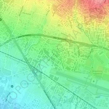
Name: Sukaraja topographic map, elevation, terrain.
Location: Sukaraja, Cicendo, Bandung, West Java, 40175, Indonesia (-6.89775 107.55644 -6.88808 107.57621)
Average elevation: 2,470 ft
Minimum elevation: 2,343 ft
Maximum elevation: 2,657 ft
Thank you for supporting this site ❤️
Make a donation
Make a donation
Gear up for your next adventure:
As an Amazon Associate, this site earns from qualifying purchases at no extra cost to you.