
Dalarna topographic map
Interactive map
Click on the map to display elevation.
About this map
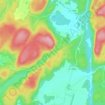
Name: Dalarna topographic map, elevation, terrain.
Location: Dalarna, Strömstads kommun, Västra Götaland County, Sweden (59.01674 11.30815 59.05674 11.34815)
Average elevation: 236 ft
Minimum elevation: 49 ft
Maximum elevation: 528 ft