
Saladoblanco topographic map
Interactive map
Click on the map to display elevation.
About this map
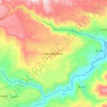
Name: Saladoblanco topographic map, elevation, terrain.
Location: Saladoblanco, Sur, Huila, Colombie (1.95314 -76.08504 2.03314 -76.00504)
Average elevation: 4,505 ft
Minimum elevation: 3,186 ft
Maximum elevation: 6,043 ft