
13610 topographic map
Interactive map
Click on the map to display elevation.
About this map
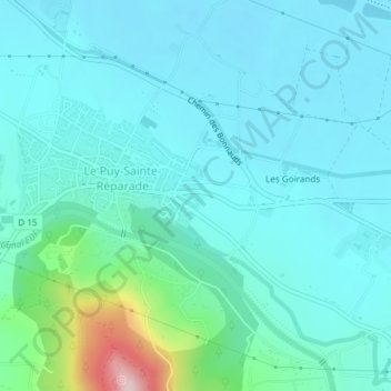
Name: 13610 topographic map, elevation, terrain.
Average elevation: 709 ft
Minimum elevation: 568 ft
Maximum elevation: 1,473 ft
Other topographic maps
Click on a map to view its topography, its elevation and its terrain.
Saint-Canadet
France > Provence-Alpes-Côte d'Azur > Bouches-du-Rhône > Le Puy-Sainte-Réparade
Saint-Canadet, Le Puy-Sainte-Réparade, Aix-en-Provence, Bouches-du-Rhône, Provence-Alpes-Côte d'Azur, France métropolitaine, 13610, France
Average elevation: 1,027 ft
Les Goirands
France > Provence-Alpes-Côte d'Azur > Bouches-du-Rhône > Le Puy-Sainte-Réparade > Les Goirands
Les Goirands, Le Puy-Sainte-Réparade, Aix-en-Provence, Bouches-du-Rhône, Provence-Alpes-Côte d'Azur, France métropolitaine, 13610, France
Average elevation: 686 ft