
Antri topographic map
Interactive map
Click on the map to display elevation.
About this map
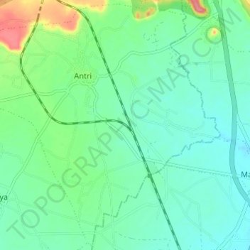
Name: Antri topographic map, elevation, terrain.
Location: Antri, Chinour Tahsil, Gwalior District, Madhya Pradesh, India (26.02025 78.18348 26.07317 78.24408)
Average elevation: 846 ft
Minimum elevation: 781 ft
Maximum elevation: 1,043 ft