
岭东街道 topographic map
Interactive map
Click on the map to display elevation.
About this map
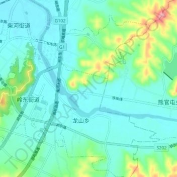
Name: 岭东街道 topographic map, elevation, terrain.
Location: 岭东街道, 银州区, 铁岭市, 辽宁省, 中国 (42.26740 123.84294 42.30934 123.91107)
Average elevation: 282 ft
Minimum elevation: 197 ft
Maximum elevation: 607 ft