
Thank you for supporting this site ❤️
Make a donation
Make a donation
Gear up for your next adventure:
As an Amazon Associate, this site earns from qualifying purchases at no extra cost to you.
Val-de-Charmey topographic map
Click on the map to display elevation.
Thank you for supporting this site ❤️
Make a donation
Make a donation
Gear up for your next adventure:
As an Amazon Associate, this site earns from qualifying purchases at no extra cost to you.
About this map
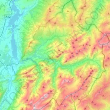
Name: Val-de-Charmey topographic map, elevation, terrain.
Location: Val-de-Charmey, Gruyère District, Fribourg, Switzerland (46.52681 7.13282 46.71003 7.28672)
Average elevation: 4,199 ft
Minimum elevation: 2,175 ft
Maximum elevation: 7,776 ft
Thank you for supporting this site ❤️
Make a donation
Make a donation
Gear up for your next adventure:
As an Amazon Associate, this site earns from qualifying purchases at no extra cost to you.