Auf dem Steimel topographic map
Interactive map
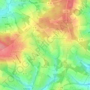
Click on the map to display elevation.
About this map
Name: Auf dem Steimel topographic map, elevation, terrain.
Average elevation: 873 ft
Minimum elevation: 722 ft
Maximum elevation: 1,024 ft

Click on the map to display elevation.
Name: Auf dem Steimel topographic map, elevation, terrain.
Average elevation: 873 ft
Minimum elevation: 722 ft
Maximum elevation: 1,024 ft