
Hérinnes topographic map
Interactive map
Click on the map to display elevation.
About this map
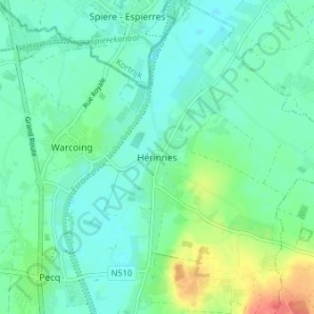
Name: Hérinnes topographic map, elevation, terrain.
Location: Hérinnes, Tournai, Hainaut, Wallonie, 7742, Belgique (50.68088 3.34236 50.72088 3.38236)
Average elevation: 62 ft
Minimum elevation: 20 ft
Maximum elevation: 177 ft