
Parc National de Taï topographic map
Interactive map
Click on the map to display elevation.
About this map
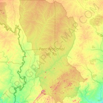
Name: Parc National de Taï topographic map, elevation, terrain.
Location: Parc National de Taï, San Pedro, Bas-Sassandra, Côte d'Ivoire (5.13433 -7.43536 6.12484 -6.77432)
Average elevation: 541 ft
Minimum elevation: 108 ft
Maximum elevation: 1,486 ft
Other topographic maps
Click on a map to view its topography, its elevation and its terrain.
San Pedro
San Pedro, Bas-Sassandra, Côte d'Ivoire
Average elevation: 269 ft