Geolocate

Sulpher Springs topographic map

Click on the map to display elevation.

About this map

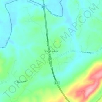
Name: Sulpher Springs topographic map, elevation, terrain.

Location: Sulpher Springs, Blount County, Alabama, United States (33.89538 -86.88472 33.93538 -86.84472)

Average elevation: 423 ft

Minimum elevation: 285 ft

Maximum elevation: 833 ft

Blount County trails, hiking, mountain biking, running and outdoor activities

Gear up for your next adventure:

🧼Biodegradable Camping Soap - Eco‑friendly soap for outdoor hygiene
🥾Women's Hiking Boots - Top-rated trail boots with ankle support and superior grip
🔭Stargazing Telescopes - Perfect for camping in low-light pollution areas shown on maps
🧦Hiking Socks - Comfortable socks to prevent blisters on long hikes
🎒Day Hiking Backpack - Lightweight backpack perfect for day trips and outdoor adventures

As an Amazon Associate, this site earns from qualifying purchases at no extra cost to you.