
Cerro de las Minas topographic map
Interactive map
Click on the map to display elevation.
About this map
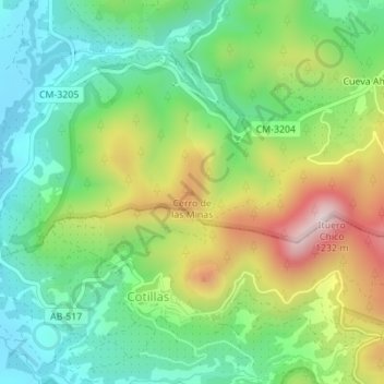
Name: Cerro de las Minas topographic map, elevation, terrain.
Average elevation: 3,028 ft
Minimum elevation: 2,490 ft
Maximum elevation: 3,967 ft
Other topographic maps
Click on a map to view its topography, its elevation and its terrain.
Río Guadalimar
España > Castilla-La Mancha > Villaverde de Guadalimar
Río Guadalimar, Villaverde de Guadalimar, Albacete, Castilla-La Mancha, 02460, España
Average elevation: 2,877 ft