
Thank you for supporting this site ❤️
Make a donation
Make a donation
Gear up for your next adventure:
As an Amazon Associate, this site earns from qualifying purchases at no extra cost to you.
上关村 topographic map
Click on the map to display elevation.
Thank you for supporting this site ❤️
Make a donation
Make a donation
Gear up for your next adventure:
As an Amazon Associate, this site earns from qualifying purchases at no extra cost to you.
About this map
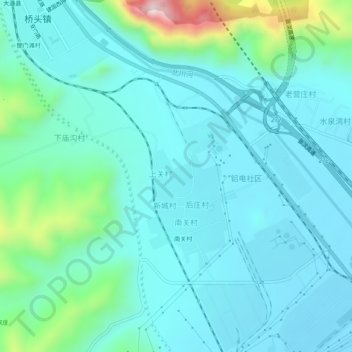
Name: 上关村 topographic map, elevation, terrain.
Location: 上关村, 大通回族土族自治县, 西宁市, 青海省, 810100, 中国 (36.88973 101.68139 36.92973 101.72139)
Average elevation: 8,176 ft
Minimum elevation: 7,894 ft
Maximum elevation: 9,573 ft
Thank you for supporting this site ❤️
Make a donation
Make a donation
Gear up for your next adventure:
As an Amazon Associate, this site earns from qualifying purchases at no extra cost to you.