
Refuge des Mouterres topographic map
Interactive map
Click on the map to display elevation.
About this map
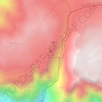
Name: Refuge des Mouterres topographic map, elevation, terrain.
Average elevation: 7,159 ft
Minimum elevation: 4,354 ft
Maximum elevation: 8,104 ft
Other topographic maps
Click on a map to view its topography, its elevation and its terrain.
Col Saint-Georges
France > Provence-Alpes-Côte d'Azur > Mizoën
Col Saint-Georges, GR50, Mizoën, Grenoble, Hautes-Alpes, Provence-Alpes-Côte d'Azur, France métropolitaine, 38142, France
Average elevation: 6,932 ft