
Ete topographic map
Interactive map
Click on the map to display elevation.
About this map
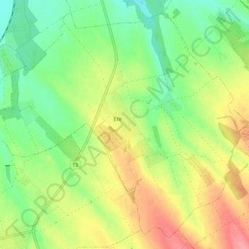
Name: Ete topographic map, elevation, terrain.
Average elevation: 568 ft
Minimum elevation: 449 ft
Maximum elevation: 722 ft
Other topographic maps
Click on a map to view its topography, its elevation and its terrain.
Tata
Hongrie > Komárom-Esztergom vármegye
Tata, Tatai járás, Komárom-Esztergom vármegye, Transdanubie centrale, Transdanubie, Hongrie
Average elevation: 607 ft