
City of Syracuse topographic map
Interactive map
Click on the map to display elevation.
About this map
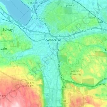
Name: City of Syracuse topographic map, elevation, terrain.
Location: City of Syracuse, Onondaga County, New York, United States (42.98417 -76.20463 43.08612 -76.07427)
Average elevation: 564 ft
Minimum elevation: 358 ft
Maximum elevation: 1,161 ft
Onondaga County trails, hiking, mountain biking, running and outdoor activities
Other topographic maps
Click on a map to view its topography, its elevation and its terrain.
West Genesee Terrace
United States > New York > Onondaga County > Fairmount > Town of Camillus
Average elevation: 548 ft
Pompey
United States > New York > Onondaga County > Town of Pompey > Pompey
Average elevation: 1,476 ft
Apulia
United States > New York > Onondaga County > Town of Fabius > Apulia
Average elevation: 1,342 ft