
Thank you for supporting this site ❤️
Make a donation
Make a donation
Gear up for your next adventure:
As an Amazon Associate, this site earns from qualifying purchases at no extra cost to you.
85049 topographic map
Click on the map to display elevation.
Thank you for supporting this site ❤️
Make a donation
Make a donation
Gear up for your next adventure:
As an Amazon Associate, this site earns from qualifying purchases at no extra cost to you.
About this map
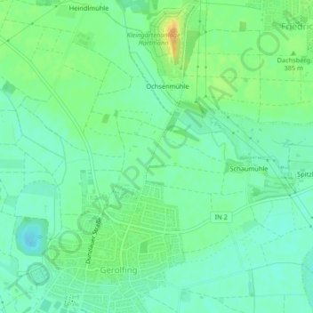
Name: 85049 topographic map, elevation, terrain.
Location: 85049, West, Ingolstadt, Bavaria, Germany (48.76375 11.35338 48.76385 11.35348)
Average elevation: 1,237 ft
Minimum elevation: 1,198 ft
Maximum elevation: 1,302 ft
Thank you for supporting this site ❤️
Make a donation
Make a donation
Gear up for your next adventure:
As an Amazon Associate, this site earns from qualifying purchases at no extra cost to you.