
藏坝乡 topographic map
Interactive map
Click on the map to display elevation.
About this map
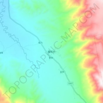
Name: 藏坝乡 topographic map, elevation, terrain.
Location: 藏坝乡, 理塘县, 甘孜藏族自治州, 四川省, 中国 (29.60924 100.39980 29.68924 100.47980)
Average elevation: 12,825 ft
Minimum elevation: 11,982 ft
Maximum elevation: 15,056 ft
Other topographic maps
Click on a map to view its topography, its elevation and its terrain.