
昂思多镇 topographic map
Interactive map
Click on the map to display elevation.
About this map
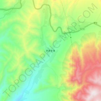
Name: 昂思多镇 topographic map, elevation, terrain.
Location: 昂思多镇, 化隆回族自治县, 海东市, 青海省, 中国 (36.12876 102.02001 36.20876 102.10001)
Average elevation: 9,377 ft
Minimum elevation: 8,005 ft
Maximum elevation: 11,542 ft
Other topographic maps
Click on a map to view its topography, its elevation and its terrain.