
Estero de Paco topographic map
Interactive map
Click on the map to display elevation.
About this map
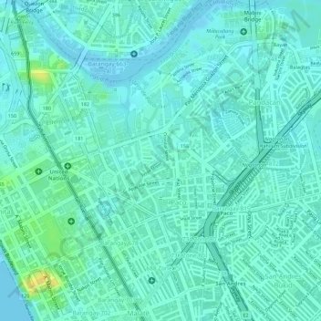
Name: Estero de Paco topographic map, elevation, terrain.
Average elevation: 23 ft
Minimum elevation: -13 ft
Maximum elevation: 89 ft
Other topographic maps
Click on a map to view its topography, its elevation and its terrain.
Provisor Island
Provisor Island, Paco, Fifth District, Manila, Metro Manila, 1000, Philippines
Average elevation: 23 ft