
Nossa Senhora de Machede topographic map
Interactive map
Click on the map to display elevation.
About this map
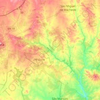
Name: Nossa Senhora de Machede topographic map, elevation, terrain.
Location: Nossa Senhora de Machede, Évora, Portugal (38.49108 -7.87260 38.62597 -7.60886)
Average elevation: 761 ft
Minimum elevation: 525 ft
Maximum elevation: 1,020 ft
Other topographic maps
Click on a map to view its topography, its elevation and its terrain.