Geolocate

Hanford topographic map

Click on the map to display elevation.

About this map

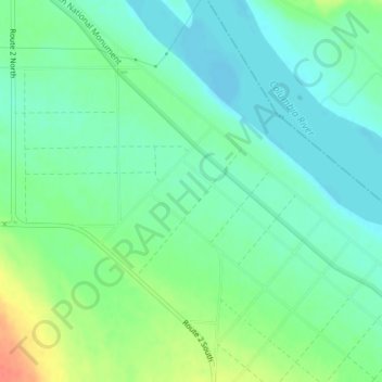
Name: Hanford topographic map, elevation, terrain.

Location: Hanford, Benton County, Washington, United States (46.56937 -119.39087 46.58937 -119.37087)

Average elevation: 404 ft

Minimum elevation: 354 ft

Maximum elevation: 512 ft

Benton County trails, hiking, mountain biking, running and outdoor activities

Other topographic maps

Click on a map to view its topography, its elevation and its terrain.

Gear up for your next adventure:

🥘Titanium Cookware - Durable, featherlight pots and pans for backpacking
🧥Men's Rain Shells - Premium waterproof and breathable jackets for mountain weather
🎒Gear Packing Cubes - Organize your backpack efficiently
🧦Hiking Socks - Comfortable socks to prevent blisters on long hikes
🧢Sun Protection Hats - Wide-brimmed and UPF-rated hats for high-altitude sun safety

As an Amazon Associate, this site earns from qualifying purchases at no extra cost to you.