
East Port Orchard topographic map
Interactive map
Click on the map to display elevation.
About this map
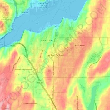
Name: East Port Orchard topographic map, elevation, terrain.
Location: East Port Orchard, Kitsap County, Washington, 98366, USA (47.48091 -122.66959 47.56091 -122.58959)
Average elevation: 226 ft
Minimum elevation: -10 ft
Maximum elevation: 486 ft