Geolocate

Luuk topographic map

Click on the map to display elevation.

About this map

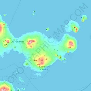
Name: Luuk topographic map, elevation, terrain.

Location: Luuk, Sulu, Bangsamoro, Philippines (5.92694 121.27284 6.00694 121.35284)

Average elevation: 207 ft

Minimum elevation: 0 ft

Maximum elevation: 922 ft

Gear up for your next adventure:

🧥Men's Rain Shells - Premium waterproof and breathable jackets for mountain weather
🗺️Topographic Maps - Detailed topo maps for hiking, exploring and outdoor navigation
🥄Camping Utensil Set - Lightweight utensils for outdoor meals
🧦Merino Wool Socks - Moisture-wicking, blister-preventing socks for long treks
🪶Paracord Bracelet - Survival bracelet with built‑in tools

As an Amazon Associate, this site earns from qualifying purchases at no extra cost to you.