
Heuem topographic map
Interactive map
Click on the map to display elevation.
About this map
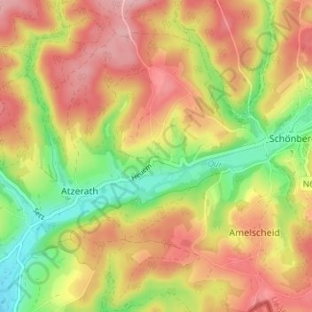
Name: Heuem topographic map, elevation, terrain.
Location: Heuem, Sankt Vith, Luik, Wallonië, 4780, België (50.26655 6.21683 50.30655 6.25683)
Average elevation: 1,585 ft
Minimum elevation: 1,289 ft
Maximum elevation: 1,834 ft