
Punta de Treserols / Monte Perdido topographic map
Interactive map
Click on the map to display elevation.
About this map
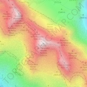
Name: Punta de Treserols / Monte Perdido topographic map, elevation, terrain.
Average elevation: 9,206 ft
Minimum elevation: 7,060 ft
Maximum elevation: 10,961 ft