
Morico topographic map
Interactive map
Click on the map to display elevation.
About this map
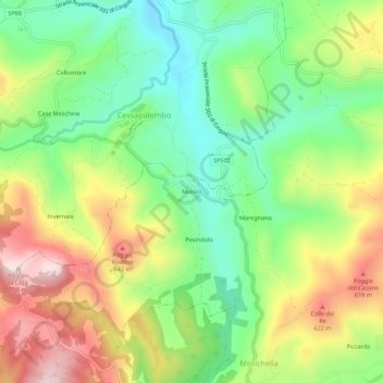
Name: Morico topographic map, elevation, terrain.
Location: Morico, San Ginesio, Macerata, Marken, Italien (43.08076 13.24486 43.12076 13.28486)
Average elevation: 1,542 ft
Minimum elevation: 1,001 ft
Maximum elevation: 2,293 ft