
Amritsar topographic map
Interactive map
Click on the map to display elevation.
About this map
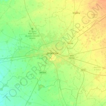
Name: Amritsar topographic map, elevation, terrain.
Location: Amritsar, Amritsar I Tahsil, Amritsar, Punjab, 143001, India (31.47431 74.71368 31.79431 75.03368)
Average elevation: 755 ft
Minimum elevation: 719 ft
Maximum elevation: 801 ft
Amritsar is located at 31°38′N 74°52′E / 31.63°N 74.87°E / 31.63; 74.87 with an average elevation of 234 metres (768 ft). Amritsar is located in the Majha region of the state of Punjab in North India lies about 15 miles (25 km) east of the border with Pakistan. Administrative towns includes Ajnala, Attari, Beas, Budha Theh, Chheharta Sahib, Jandiala Guru, Majitha, Rajasansi, Ramdass, Rayya, Verka Town and Baba Bakala.
Other topographic maps
Click on a map to view its topography, its elevation and its terrain.
Gumtala
India > Punjab > Amritsar I Tahsil
Gumtala, Amritsar I Tahsil, Amritsar District, Punjab, 143011, India
Average elevation: 755 ft