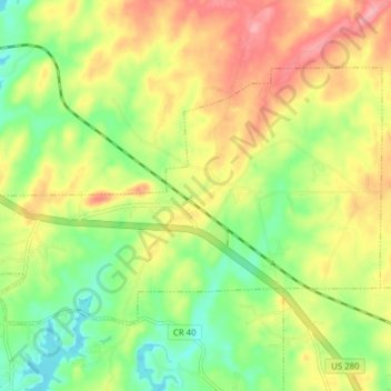
Jacksons" Gap topographic map
Interactive map
Click on the map to display elevation.
About this map
Name: Jacksons" Gap topographic map, elevation, terrain.
Average elevation: 620 ft
Minimum elevation: 459 ft
Maximum elevation: 801 ft

Click on the map to display elevation.
Name: Jacksons" Gap topographic map, elevation, terrain.
Average elevation: 620 ft
Minimum elevation: 459 ft
Maximum elevation: 801 ft