
Candoni topographic map
Interactive map
Click on the map to display elevation.
About this map
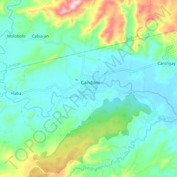
Name: Candoni topographic map, elevation, terrain.
Location: Candoni, Negros Occidental, Western Visayas, 6110, Philippines (9.78788 122.60228 9.86788 122.68228)
Average elevation: 794 ft
Minimum elevation: 492 ft
Maximum elevation: 1,706 ft