
Dunk topographic map
Interactive map
Click on the map to display elevation.
About this map
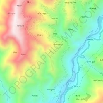
Name: Dunk topographic map, elevation, terrain.
Location: Dunk, Pauri, Pauri Garhwal, Uttarakhand, India (29.94109 78.72863 29.98109 78.76863)
Average elevation: 3,114 ft
Minimum elevation: 1,991 ft
Maximum elevation: 4,783 ft