
Lamberg topographic map
Interactive map
Click on the map to display elevation.
About this map
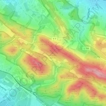
Name: Lamberg topographic map, elevation, terrain.
Location: Lamberg, Bielefeld, Nordrhein-Westfalen, 33604, Deutschland (51.98940 8.54282 51.98950 8.54292)
Average elevation: 679 ft
Minimum elevation: 453 ft
Maximum elevation: 971 ft
Other topographic maps
Click on a map to view its topography, its elevation and its terrain.
Wolfsbach
Deutschland > Nordrhein-Westfalen > Bielefeld
Wolfsbach, Bielefeld, Regierungsbezirk Detmold, Nordrhein-Westfalen, 33729, Deutschland
Average elevation: 338 ft