
肖金镇 topographic map
Interactive map
Click on the map to display elevation.
About this map
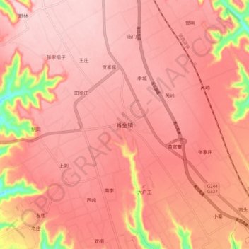
Name: 肖金镇 topographic map, elevation, terrain.
Location: 肖金镇, 西峰区, 庆阳市, 甘肃省, 中国 (35.54528 107.60611 35.62528 107.68611)
Average elevation: 4,295 ft
Minimum elevation: 3,707 ft
Maximum elevation: 4,465 ft
Other topographic maps
Click on a map to view its topography, its elevation and its terrain.