
Harisal topographic map
Interactive map
Click on the map to display elevation.
About this map
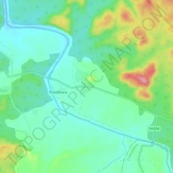
Name: Harisal topographic map, elevation, terrain.
Location: Harisal, अमरावती, Maharashtra, India (21.51553 77.09110 21.55553 77.13110)
Average elevation: 1,319 ft
Minimum elevation: 1,188 ft
Maximum elevation: 1,627 ft